- China Hyway Group Limited


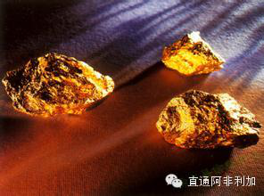

Africa, covering a total area of about 30 million square kilometers, has rich mineral resources. However, due to lack of exploration data, it is still unknown how many mineral products reserve in this broad and vast land on earth. To make clear the potential of mineral products in the second largest continent in the world, World Bank will launch a foundation project amounting to USD 1 billion to draw Africa’s mineral map.
In the “20th African Mining Investment Conference” held in South Africa at the beginning of February this year, Paul Deza, Oil-gas and Mineral Products Department Manager of Renewable Energy Division of World Bank, put forward that in spite of having rich mineral resources, Africa is still a land subject to the further exploration in the world, for the reason of existence of a huge technological gap, and it is quite necessary to perform a large-scale geological survey to ascertain the reserve of mineral products. Deza initialized a five-year project titled “USD 1 Billion of Mineral Map” in the conference. He said that there is a bank agreeing on contribution of USD 200 million and he hopes the governments in African countries, donation organizations and mining companies could offer the rest of USD 800 million.
Deza expressed that lack of application exploration technologies in Africa causes the lack of geological data. And, lack of geological data brings about an obstacle to the exploration company for selecting which country as the mining destination. Satellite and aerial-photo technologies including the geographic information system will be widely used to draw a comprehensive and technology-driven mineral exploration map of the African continent and a large amount of fund will be applied to purchase and bug relevant technologies. It is anticipated that an important part of investment will be applied to the information systems and data management hardware such as servers, IT platforms, cloud storage and different types of sensing data. The drawing process of this mineral map will cover integration of numerous data sets, which will be conductive to the identification of possible mineral reserves.
Erik Kamala, General Manager of LocateIT specialized in sensing technologies in Kenya, welcomed this project. He said that technologies develop rapidly in the field of mineral drawing and become more precise and economic. Aerial photograph and camera shooting, satellite sensing, UAV, mobile phone, geographical information system and other technologies can be used to acquire the data for the mineral map. Deza agreed on that opinion and added that except for aiding the positioning of mineral products, such technologies can be also used for water resource management, land use planning, infrastructure, biodiversity planning, etc.

中国昊远